
By: Dave Klausler
Three years ago, my buddy Ed and I turned back only some four miles into our hike up Mount Whitney. Still dark and roughly at Mirror Lake. Our legs had been absolutely fried coming down Boundary Peak, the highpoint of Nevada, just thirty-six hours previous. Neither of us were in prime condition, and it showed in lack of recovery and probably lack of initial capability. “I do not want to be one of those embarrassing pieces-of-shit who call in for rescue,” Ed said to me that early morning on Whitney. Yes, we could have made the summit, as uphill was not the issue but the quadriceps femoris were obviously still spent – revealed on any briefly hiked decline – and the upper reaches of the Whitney trail were said to be very steep; retarding and managing the downward fall is critical. “Okay,” I replied… we turned back. The side-trip to Lone Pine Lake on the return did little to quell my disappointment. I do not like to leave things unfinished (see this: Mount Katahdin). So, what led to the failure?
We had driven through the night to the high saddle launch point. It was a welcoming 87˚F at 5:30pm local with no trees (or water) present in the high desert around 9,000’. The last half-mile on the very steep and loose FWD road was dicey – Ed leaning away from the invisible edge multiple times. You may have read me before: I am a fully qualified driver and I know the capabilities of my vehicle. Ed was silently praying that this was true. Parked and exited. No marquee was visible, so we took a tour of the grounds for about an hour to confirm the trail and general route. No fire; freeze-dried dinner on the stove – a couple of ice-cold Panda beers with road snacks. Baking in the sun set still high in the azure sky, sitting around in canvas camp chairs, counting the very long minutes until sunset. It took forever with nothing higher blocking the orange ball descending in the west. We checked and re-checked our gear for the hike. For quick post-hike departure, we decided against the tent and slept in the bed of the Hondo. Even though we had no sleep the previous night while behind-the-wheel, the current attempt was restless at best, calm and silent with billions of stellar objects visible in the crystal-clear warm and dry sky.
Up just before and on the trail by 5:00am… in the dark – headlamps on. Light fleece uppers for both of us, three liters of water and three big bars for me, four liters and a handful of snacks for Ed – maybe some Gu. Full shells packed of course – wind was certain, rain was highly unlikely. Boots, not trail shoes – rough country on a marginal trail. Two sticks each, although my second was stowed. First up a bit on tedious switchbacks and then as daylight eventually broke, we were out onto some relatively easy firm sandy miles. We rested well at the high trail junction and a lone big boulder. The rest of the hike was much steeper.
Not unusual for the not-so-popular trails, this one had no signed markings at all and near the long sub-summit ridge we ventured off into what turned out to be the hard way – for a while. Off-trail a bit and into very soft, steep, sliding scree – a lot of work in a short span of time. A little Grinch stepping to avoid a very long slide to oblivion. Now fully light we were soaked with sweat from the dynamic action of that section.
The upper rock then seemed like a breeze, but still steep. I uncharacteristically slipped on the summit mound boulders landing nicely on my right tibia, the volume of blood shocked Jimmy and Jojo up there who had summited just before us. Neither enough to fill my boot nor bandage up – the dust and dry air sealed her up in a matter of minutes. Seven arid miles up to a respectable 13,140’.
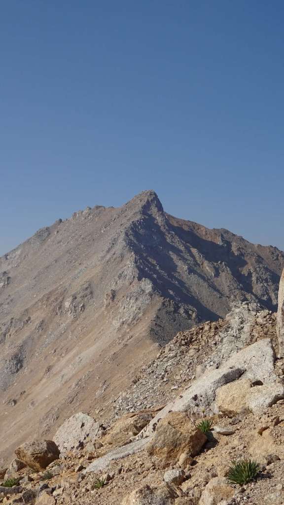
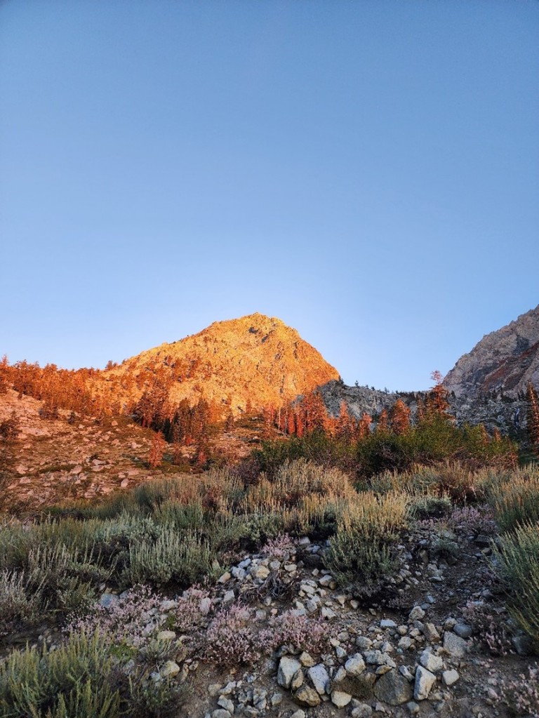
Check that sky… Oooo old sol cooked us for the rest of the hike. Oh, that is Montgomery Peak in the background… in California, and a couple hundred feet higher – not interested.
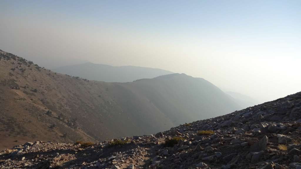
Return route was straight forward except that we made a vocal note to each other NOT to go too far left back into the quick-sand scree. However, by doing so, we over compensated going too far right and onto a viewing trail. Jimmy and Jojo throwing us a much-appreciated bone by screaming at us from a mile or so away. We hit the section of trail that itself was scree and slid forever, both ass-dropping more than once – without damage. Our boots filled multiple times. The grade in this shot is deceiving.
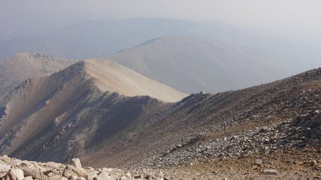
If you look closely at this one, you can see the trail that straddles the ridge in multiple places – the most prominent being the wraparound on the orangish peak mid-left. Yes, it seemed a long way off.
We were tired when we hit the rest-boulder once again, but the next few miles were almost flat. We came upon a small herd of wild mustangs with both the alpha stallion and broodmare quite defensive. The foals came much closer. We motored on, now realizing that we had been hauling ass on the way up as this section seemed much, much longer. Now almost noon, we came to a section in scraggly bristlecone pine that neither of us remembered because of the earlier darkness and pulled in for a rest. It must have been 10,000 degrees in the relentless direct sun. We couldn’t get under the trees’ shade because they were growing out of a strangely loose rock pile. Ed, my friend, was spent, as was his water, but he knew as well as I that the end was near. Turns out that it was not so near. We crested the final hump and witnessed the switchbacks down to the vehicle. It was just brutal slowing the downward motion and endless back-and-forth while our heads and bodies melted. A couple short breaks with my shared water and we made the finish at just before one – completely drenched in sweat.
We first drank an iced-down half-liter of water each – then an ice-cold Panda for good measure. The sun was straight up with no wind. We unpacked a back-up shirt each, toweled off, loaded up and hit the loose rock path with the A/C in the Hondo cranked to 11. Spent. Oh yeah, that was Ed’s FIRST highpoint, my 42nd or so. That’s it, we stopped down lower for a quick tour of the so-called “mine”, Ed cringing again at the marbled “road”. On through the eastern part of southern California towards the Whitney Portal campground. We wound down and iced up in Bishop. Up high, we bagged a first-come-first-served campsite and set camp. We cooked our steaks on the fire platen and reclined with a few brews. Restless night and up early, grab-bag gifted Spam on the grill.
We toured the Portal store and checked out the whole area including the sprawling trailhead with its large supply of shit-bags – yes, you must pack out your human waste from the Whitney Trail (we saw TP in many spots while eventually on the trail). Down to the lower campground to bathe in the warm sun and chilly creek water. Our legs were still dead meat. We picked up some supplies in Lone Pine and desperately tried to reach the Inyo Forest people to beg for a change in Trail Permit (only 50 hikers allowed per day). At the time they were woefully understaffed to handle the Lottery and processing thereafter. A dozen calls to very nice people and an hour wait while in the cool park along the upper Los Angeles Aqueduct. No dice: no cancelations were made, and subsequently could not exchange our date. Back up to camp, a fire and modest dinner. The bears woke us at around 10:00pm from campers banging their pots and pans to scare them away – not too effective. We were up earlier than planned at about 3:00am. Having no additional nights in the campground, we packed up completely and drove the five minutes to the Portal parking lot. As advised sternly, we emptied the truck interior completely into the large bear-proof lockers and walked over to the trailhead, flipped our headlamps on, checked for bulletins, grabbed a few shit-bags and hit the trail. You read the rest up top.
So, here I am… round two, writing from my 8,400’ campsite at the Whitney Portal campground.
Even before this setting, I had arrived at a 6,100’ campsite at Gray Meadows – about an hour away from the big trailhead. I had to camp there because no reservations were available for the Portal campground (normal). Wait, then why did I just say a few seconds ago that I was writing from the Whitney Portal campground Well, I had always intended to undertake a training hike, pre-Whitney, just not as severe as that which Ed and I had done years ago. Given that, I had plotted a hike above this campground, yet still attaining sufficient altitude to tax my system. Due to my activities at that campsite, I never got around to putting pen-to-paper.
Yet earlier still, I had stopped in Bishop, CA after 2,000 miles of driving to visit the Inyo N.F. local Office – closed, of course – Labor Day. But a contracted Fire Guy happened to be rolling out and stopped at my side. Long chat revealed that Reservation.gov had neglected to inform me (as a reservation holder) that both Gray Meadows AND the Whitney Portal had been affected by the recent Tropical Storm Hillary… the severe and unusual rain overwhelmed the mostly high desert and had washed out many roads and campsites. The note on the door of the government agency said simply “Onion Valley Road ‘soft’, travel at your own risk [up to 9,200’]”. Fire Guy said “Hah… ‘soft’ could mean anything.” Great. I located Gray Meadows and yes, there was partial washout of both campsites and roadway (black-top). Several campsites were clearly beyond use, but my site was in decent shape despite the residual water moistening the mixed earth ground. The campground in general was set beautifully amongst a mixed bag of large trees and shrubs providing shady relief from the blazing 80°F ambient. Due to the recent heavy precipitation, the nearby creek was white-water and loud. A couple of large ravens checked me out… I was otherwise alone.
I set camp just as Joey from R.gov drove through, stopped, and we both chatted and laughed at the slipshod performance of his employer. No campground “host” had even been hired for this place – he didn’t know why (hosts are very common in federal areas for firewood, paper-pushing and maybe diapers for the city folk). He left, taking only my name and verifying me on the Master List. I then drove up to scout the Onion Valley trailhead – blacktop damage, but passable (soft?). I chatted up a few hikers coming down and out – all was good. The trail entrance was clearly marked, and the marquee had both a decent map and useful documentation – unneeded by me. More than fifty cars, trucks and RVs packed the small lot – overflowing down the broken roadway. This was a common exit day, so I figured no sweat for my use the next day. The best license plate was Mississippi… good distance (and a fellow flatlander) but I had him beat by a couple hundred miles – I checked it off my list – otherwise 95% California plates. Back to camp. Dinner and early bed.
I arose before light… that’s not unusual but an additional element was Pacific Time Zone: I wasn’t quite certain when sunrise would occur. Quick breakfast then I packed the same gear and load into my daypack that I would be carrying up Whitney. Up to the trailhead over the damaged roadway. Not bad timing as you can see the sun had just tipped the lesser summits at half passed six.
The trail was supposedly steeper than that of Whitney but topped out at only 11,700’ in five miles. I passed no one going up but when I hit the scree switchbacks, I could see someone coming up from a mile or so down. Then, out of nowhere some dude comes down… I parked and waited. Long chat… it was work for me above 11,000’, but he stated matter-of-factly that my pace was noteworthy as he had been scanning me from above for thirty minutes. SEVENTY-FOUR years old and had gone in seven days previous with only fifty pounds. Light gear, light food… light guy. He moved on but said that I was likely to catch him on the way down later, and he would tell me of his “Whitney Stories”. I made Kearsarge Pass in just over two hours – pretty good.

While I choked down a new brand protein bar while resting on the saddle, a group of EIGHT flowed in an extended stream to join me. Only ONE was younger than my sixty-two years at sixty-one. We talked about gear… one guy had only a forty-two-pound pack for EIGHT days. Light tent – one pound three ounces – which I asked about.
Badger: “Have you ever had that thing in a 30mph wind, driving rain or hail… snow?” [These things are relatively common in the high mountains.]
Master Hiker: “No, no, and no.” [Slumped shoulders.]
Badger: “Uh huh, I’ll keep my three-five MSR, which HAS been in all that.” [Fucker.]
Additionally, they all claimed to have “live” food, not just freeze-dried. I suppose Group Gear split eight ways would lessen the load for each, but I think that they were exaggerating low – maybe they don’t count the water (weight) – I do. Done.
On my way down, I stopped and chatted with at least a dozen hikers. One guy had on a huge gawdy Rolex. After miscellaneous establishing words, I asked him “What the Fuck, aren’t you concerned about damaging it?”
He looked all confused, and said just: “No.” Alrighty then, I moved on – ever-pleasant.
Strangely enough, upon return, I was sitting in the torture chair in my “work” clothes and the dentist (fixing his questionable work) looks at my stainless steel Oris and asks, “Do you wear that while you are out hiking?” I said incredulously “No way, this watch means something to me [beside the cost], I wear the cheapest Casio plastic piece of junk possible out there.” No response.
Unofficial Trail Data; Average Age: SIXTY, a handful over SEVENTY, with 73yo Granny hauling 55#. I looked around this absolutely beautiful area and had no answer as to why my former hiking buddies could not, or would not do this any more. I’ll speak on this later, which I did, with other hikers. I will add one more detail: most of the older hikers were slim.
Up and down, ten miles round-trip with 8,000’ elevation gain and loss in just under five hours – including the chit-chat. Yes, I caught up to Grampy and laughed at his unsurprising experiences on Whitney – all stupid-human related. Back to camp for lunch.
As I mentioned, I was unable to obtain a campsite at the Whitney Portal, but cancellations are common. I really didn’t want to have to drive nearly an hour to the trailhead at 2:00am (on hike day), so I drove down to the F.S. office in Lone Pine to check things out. The Government Employee smiled at my approach and easy question.
GE: “Sorry, we have nothing to do with Reservation.gov; cannot tell you anything about campsites. You’ll have to call them or use their website… OR drive up and see if there any First-Come-First-Served sites.”
PATHETIC. It’s thirty minutes one-way.
I’m the only one visiting the office at the time and present are at least a half-dozen Government Employees (several more out working the fully green grounds (in the DESERT)).
Badger: “OK, can’t you just take a quick look on their site for me… so I don’t have to burn an hour or try and use my phone?” [It is a USFS campground after all.]
GE: “No.”
Badger: “Really? [Her computer is right next to us.]
GE: “Sorry… by the way, the Portal Road is washed out. Here’s the detour route.” [Pointing to a hand-highlighted, poorly photocopied map.]
Badger: “Is the detour well-marked?” [I might be driving it at 2:00am.]
GE: “Should be obvious,” from the chubby, teen-aged, blue-haired, black-nailed, nose and lip pierced, tattoo-covered, untucked Government Employee. Yes, I do know that that has no bearing on her ability to perform the tasks at hand… you may fuck completely off any way.
Badger: “Swell.”
I drove up… the signs were obvious (you asshole Badger). I found Bob (really) the campground host and gave him my story – animated generously of course.
Bob (nope, I couldn’t get all three nights, but) “If you come up tomorrow morning early, I’ll have #19 set aside.”
Badger: “Bob, I get up very early, hmmm, is eight OK.” [I really want this; he nods.]
SWEET! No long drive in. Back to camp. Dinner, fire & brew.
I packed up everything the next morning, drove the fifty-five minutes and met Bob at 8:01am. Good to his word, I was set for the two nights. I tipped him and raised his eyebrows. Not really a whole first night as I was planning to hit the trail at 3:00am but having a recovery night right there afterwards would be great – I’d probably collapse after the twenty-two miles.
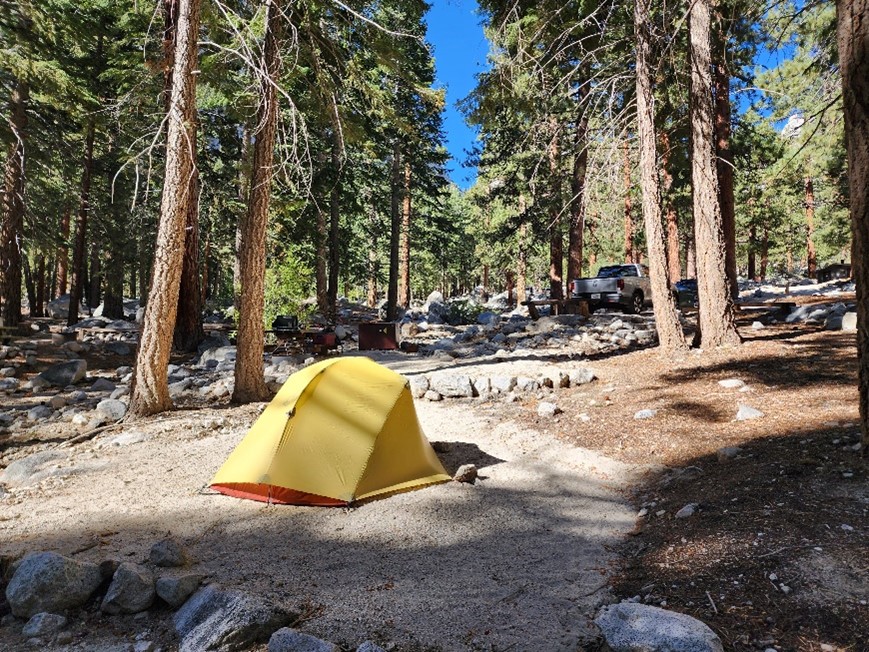
NOW, I sit here in site #19 having set camp. Maybe a little reading. I had been thinking a lot… I had a lot of time while driving two-thousand miles. The people on the trail reminded me too… driving alone all that way really stunk (the license plate challenge (view all 50 on passers-by) can only take up so many seconds and is clearly impersonal). Camping alone isn’t what I enjoy. Maybe it takes getting used to, but I don’t think so. Maybe my brother is not yet done hiking, I’ll have to check again. As many have said (and will say while on the Whitney trail): “maybe it’s you Dave”. Maybe so. My DDS pal Eric seems to be interested, maybe we’ll give that a go. It does take some level of fitness for sure, but as many of those same hiker interactions indicated: “Get lighter gear.” I did not mention Gerald hauling TWO three-liter Nalgene bags of gin in his pack. Finally, you may not know this about me, but I am nervous… much like just before my first Black Belt testing had begun. My actual thought is: “Let’s get this bitch DONE (and then drive two 1,000-mile days home).” Four Cali Gals pulled in next door and set very big tents. Here’s mine:
Afterwards.
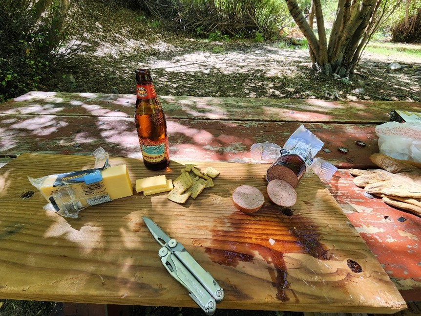
I had hit the tent twice trying to rest – or better still: sleep. In the afternoon session I did dream… maybe an hour. I had gotten out for a small dinner of sausage, cheese, and crackers (again) – forcefully drinking 16oz of water. Back in at 6:00pm and stared at my eyelids for hours and hours. I did notice two sessions of unrecallable dreams – maybe a couple of hours total. At 1:30am I could stand no more and got up, dressed into my prepared outfit, ate light (do you know Chomps? Meat sticks – I love them), had my scalding tea, shat, and hit the road. Vehicle temp stabilized at a balmy 48˚F. Five minutes later, parked in the Portal lot, I stripped off my camp outers, tightened my laces, lit my headlamp, extended my right-hand stick, grabbed and stowed a shit-bag, put on my gloves, checked for news updates on the big board, and hit the trail. It was 2:45am.
OK, here we go… the actual hike.
Starting at 8,400’ (Portal trailhead) and going up to the Summit of Mount Whitney at 14,505’ – the tallest in the lower-48. That’s up more than six-thousand feet in eleven miles – 22 RT.
I reminded myself to calm down, slow the pace and keep moving. After just a half an hour or so, I could see the hikers above me, and eventually those below me – the headlamps are bright – mine was set to minimum lumens (I was unjustifiably concerned about battery life (nerves)). Even in the dark, I recognized landmarks that Ed and I had passed last time out.
My pace was even, with breaks every hour to remove my pack, sit and water up. I checked; none were even five minutes… I couldn’t seem to shake the get fucking moving mode. I should have known better… I was catching people. Above Lone Pine Lake appears the first of thousands of rock stairs – much appreciated going up. I knew the area I was approaching below Mirror Lake (one dude called it a refuge camp due to the dozens of tents spread everywhere), and the Ranger had said the big rain had re-arranged the creek, so I tucked in behind a chattering group of EIGHT that looked from a distance like they knew where they were going (I would later learn that these hikers were being guided). Maybe a mistake… they struggled to move across the hand-hewn logs spanning the various threads of the waterway. Several before me had stepped in to the icy water (as evidenced by the wet footprints all over the place). The braided water spread across a large flat expanse of small rocks with no visible markers, but they made their way across, hopping here and there, and to the signed Up section. Shortly thereafter I passed them – they were very courteous.
I would describe the majesty of this section more completely, but no daylight yet. Just keep swimming.
Still dark of course, strolling upwards, keeping it moderate. Above Mirror, I could not immediately locate the trail as I entered an exposed rocky outcropping – flat and featureless. Again, I had to remind myself to calm the fuck down – thousands of people had hiked it – open your fucking eyes and take ten seconds to look around (fucking nutcase). Shocking I know, but I found the route in eleven seconds. Up, up, up, Hobbitzes. Resting again, a couple came at me with their ten-thousand-watt LED lamps burning holes in my face, and pulled in. I had to look twice… I was dressed light, but they had just T-shirts up top, and it was still in the 40s. Wow. We chatted quick, they were young and from the Fatherland and had trained in the Swiss Alps. I mentioned #1 Son at TUD, and they said “…fantastic school.”
Just a side comment here… I have no idea why I choose the items to speak to people about. Some are obvious like strange gear, no shoes, Jack Daniels instead of water, but it’s instantaneous… roll with what my subconscious impetus throws at me. And just as soon as a great detail is revealed, we part ways. Trail shit… task to complete – moving on – it’s understood.
Onwards.
I could see a dozen or so ahead of me and very high up.
The sun finally hit the tips of the peak ridge as I moved in and around Consultation Lake with the loud streams flowing. Light gradually showed the faces and true color of the miscellaneous clothing worn by my fellow hikers.
You might say: “Hey Badger… why no pictures?” Because I’m busy, not gonna dig out the phone and there are thousands of images online showing what I am in. Besides, as Wifey says: “Rocks, trees, lakes and trails… been there, done that.” Strange, but it just didn’t seem important to me.
Eventually, now light, I, we actually, moved in to the expanse of the Trail Camp area. A big pool of snowmelt was nearby the otherworldly rock mounds and channels – some snow too. Again… dozens of (tiny) tents. The hikers had bunched up a bit, and the campers were milling about. We viewed the wall in front of us. I moved near a couple guys who looked serious.
“So, this is the start of the infamous 99 Switchbacks?”
“Yep.” [Pointing.]
A few minutes later I was at the base, hit the obvious trail, and at the first upward u-turn yelled out: “THAT’S ONE!” One single middle-aged Asian lady laughed. Humorless fucks.
I’m still in trail shoes, shorts, t-shirt and fleece upper. Still upper 40s at most.
I tagged in with a couple of guys from Boulder… we went several miles loosely together – up and (eventually) down. I knew gear, clothing, food, so did they. I had been places, so had they. Many things were discussed – it was a long hike. Funny thing is, I recognized his Fjallraven pants (I have the same at home), and while on the topic (he’s a serious climber) he says: “I couldn’t believe it when you passed me… who’s this guy in SHORTS?” A nice pat for the Old Badger’s ego (and reinforcement that my fitness may have been sufficient). Okay, some may actually be interested… here’s my stuff:
- Arc’teryx (shell) jacket
- Mountain Hardware (shell) pants
- Wells Lamont gloves (insulated leather)
- Mountain Hardware mid-weight fleece upper (hooded)
- Patagonia T-shirt (practically nothing)
- Backcountry generic all-purpose shorts (mesh lining)
- Smartwool mid-weight hikers (shoe-height) +extra pair
- Salomon Trail runners (I bought them for snow)
- Body Solid cap (free from my weight equipment dude)
- Smith runner shades (for driving normally)
- Lowe Alpine pack (super adjustable)
- Black Diamond sticks (adjustable)
- Black Diamond headlamp (long battery life, multi-mode)
- Sigg 1.5L aluminum bottles
- Potable Aqua water purifier tablets
- (3) ProBar (fruit, nuts, non-GMO soy), (1) BulletProof (collagen protein), Clif Bloks (electrolyte)
- The almighty Casio F92W watch
- Leatherman Wave multi-tool
- 3M Scotch nylon reinforced tape
- Ziploc bags
- Dawg Tag (for Wifey)
- Maps (minimal, trail is well known and well pounded)
This hike’s pack weighed in at 18# – full water.
We, the scattered hikers, topped the surprisingly well-maintained 99ers onto the saddle and sign noting the division between the John Muir Wilderness, and Sequoia National Park; I can see for miles and miles and miles, oh yeah. I debated mentioning this, but now that I have thought of it a half-dozen times, I will. Just before the saddle, the route forced a traverse of snow – hard as ice due to the early time of day. My CO hiking pal and I had encountered an Asian lady, maybe 32yo coming back down and a bit distressed repeating: “I can’t, I can’t… it’s too narrow.” After consoling her, and checking the scene out, he asked if she had spikes – she DID (I had nothing and was seriously looking at routes around the ice). She wanted to go out on the very steep un-switched boulders and go straight up (over a non-visible hump). I advised against this due to the work and unpredictability of the unseen. To my shock CO said, “You could do that… the trail is over there somewhere.” I glared needles at him – she was clearly out of her comfort zone, and he was probably making it worse (we spoke to each other later – he retracting). She attached her very good spikes (Kahtoola), with me assisting her balance and sticks. CO noting “those are great!” She calmed down with our combined confidence and commentary and I led on. The ice had been pounded (and melted on previous days) into large footprints. I’m using my stick aggressively and stepping very cautiously. It was indeed quite slippery for my unenhanced footwear. Step by step, stopping every ten feet to status check her, reminding her to stay centered over her feet (the natural tendency is to lean forward, or into the slope), CO backing her up, we made it across. She was almost crying with joy and exuded a never-ending stream of thanks. At the aforementioned saddle, she began screaming – at her distant hiking group – they had left her at 13,000’+, alone, and scared out of her mind – nice. They all caught up to each other eventually.
I knew the trail dipped after the saddle on the Crest Ridge section, but viewing three hundred feet down and way, way out gave me pause. Work… still. Also, it was not a stroll across those two something miles, oh no, the west exposure allowed direct strong cold wind to pummel us all, while weaving the rocky route. The spires blocked almost all of the warm sun. The western exposure was a cliff, thousands of feet down sharply. We really spread out, each deciding on the tact, the pace, the effort to expend. I was alone shortly, motoring, but finally, above 14,000’, I had to suit up as I was getting cold (no upward work). I sat, drank first, and put on my full shell – perfect – winter-like. I would glance frequently upward and outward, and it always seemed far away and high. Finally, I could see the summit hump and hikers heading up. By now, several had passed going downwards. A Japanese guy, yes, bypassed me (downward) while I was working a small incline and turned around to speak. He described, in paused English and good body motion what was yet to come, in detail, with advice – none of the other eventual dozen+ downhillers said a thing.
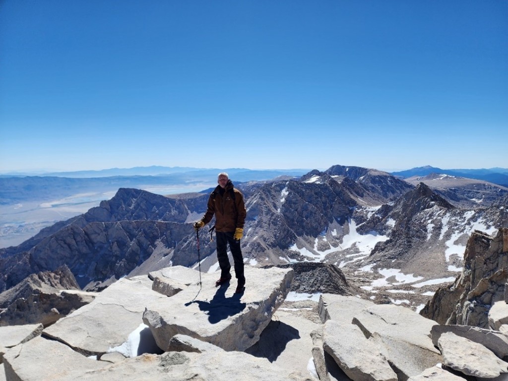
I hit the spot the fellow had mentioned… actually, I could see it, and the hikers around it well before – their colors really stood out – not like my purposeful brown-black ensemble. A substantial snowbank remained high (could have been recent – unknown), blocking the trail. No one had traversed it; all were scrambling around… maybe boulder hopping is a better description. In either case, it was VERY steep, and tiring, I paused many times, as did the few other hikers near me. Finally, over the hump and the summit shelter was visible. Even then, I rested, huffing. I moved on beyond the structure to the obvious true summit area. More than a dozen people were up there. Ascenders and descenders traded continually, so the count was always around twenty up top and a dozen back at the shelter. The area is large and flat with deep cracks separating the plates. Lots of chit-chat was going on of course. Hundreds of photos were posed and snapped. Many of us recognized each other. I parked at about 10:35am, off-loaded, and dug out the phone for the first time. I had the nearest amiable person snap a few of me… she was generous with her time, patient with my tired actions, and took many. CO came up (he had side-tracked to summit (failed) nearby Muir Peak (another 14er)) and snapped a dozen more for me.
I sat, drank, broke out a bar, and was subsequently overcome with emotional relief. My oft-broken body had held up, the current injuries had stayed below the inhibiting threshold, and I was incredibly thankful for that – no specific target for those thanks – perhaps the hiking gods.
Many had food; of course, some white bread shite sammiches were around. But this topped it all… dumped out right next door to me on my rock:
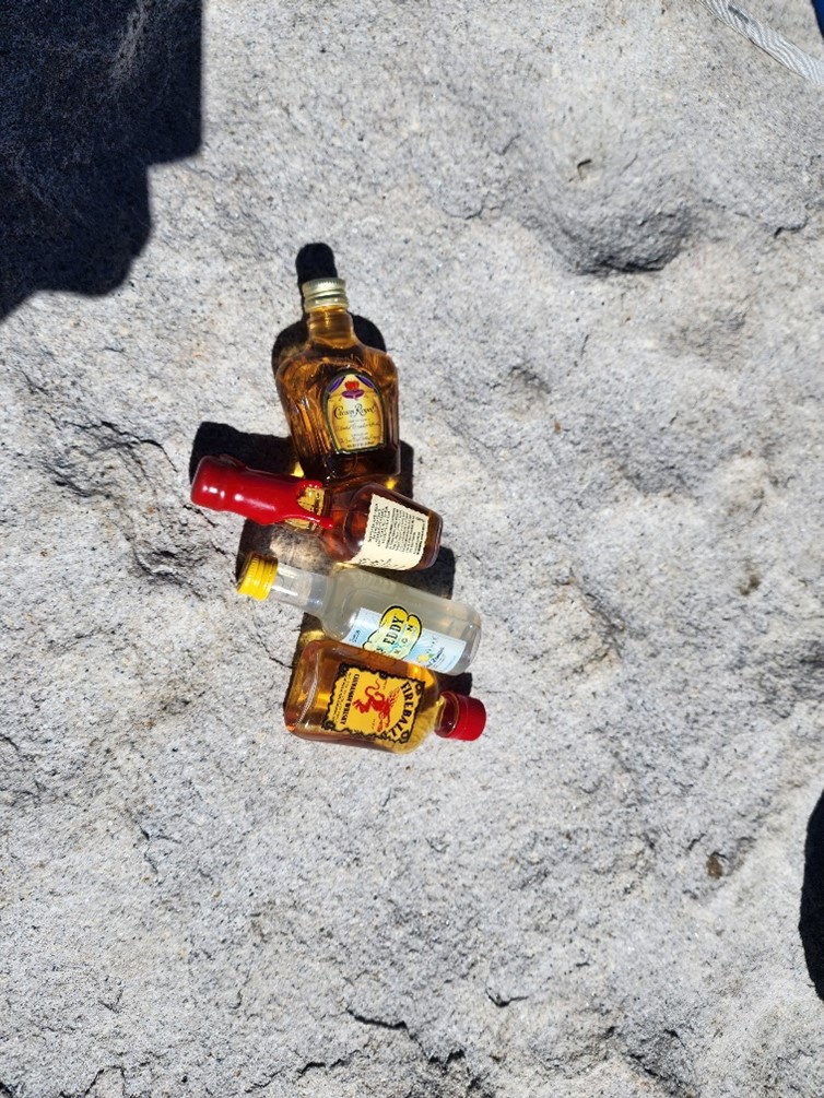
Man, I was tired – mostly from that last off-trail steep scramble, any amount of that booze would have knocked me down. The owners were young. It reminded me of my own history with Brother Jape, and I told them the related summit story [ Chicken Out? Panda Mayor? What Gives? https://pieceofmindful.com/2022/08/23/the-klausler-chronicles-highpointing/], with him always providing similar.
I chatted again with CO. Weather reports – I don’t know where these people were acquiring that info – said 30°F and 30mph winds, never mind the absolutely merciless sun. As I would later tell the Cali Gals: “You could freeze and get burned at the same time”. It felt every bit that low and high after I fully cooled off. Many began assessing performance. Here you go, believe it or not: I was the fastest up (due to differing start times) and I was the oldest (by more than a decade). Neither of these are a big deal, really, because many others have RUN up that peak, and many very much older than I have summited. But it made me feel good anyway. I rested, commiserated, drank, and ate for about half an hour. As planned, I added to my outer gear. I knew the sun would now be in my face, and my fine Scandinavian skin would not be up to the task – previously “tanned” or not. I broke out the cap, and the glasses and pulled my hood over the top. DANG… sorry, I thought that I had a snap of that full outfit – nope. I headed down. CO stayed with his jovial partner (they had arrived about fifteen minutes after me).
I passed the Asian lady in the scramble zone… she profusely thanked me again. CO would later report to me (he was much faster downhill) that she had summited AHEAD of her group (that had ditched her) – YES!
So now, fun times – NOT! No problem screaming down and across the crest ridge (I tagged in with another group – chatting occasionally from the rear) but then the Dip had to be reversed – and it was big time work… I was huffing every hundred yards, and still dropped the group (upwards) and moved ahead. Onto the saddle, but just below, there was a group sheltering behind a rocky spire prominence.
Badger [yelling to no one in particular, referencing the sign]: “8.7 miles to go… I’m practically down!” Laughs from all. Onward.
The 99ers – down… brutal never-ending step-downs. The sun: blazing – but not hot in temp. I maintained my hourly break schedule. The snow was much softer but still very slippery. There was still ice in shaded areas, “dicey” as the Ranger had correctly warned. The previous group would pass me, and I them… back and forth. CO was ahead and looked very fast – his portly pal too. A few of the group(s) turned out to be ad hoc and were now splintering to their own goals. I would not see any more than a two-some from that point on. I stripped off my jacket at some point well below the wind. Bottom of THE switchbacks and I caught CO. We compared mental notes once again. We estimated 50, maybe 55°F while sitting at Trail Camp. He sped on after his pal reappeared after attempting a forced #2.
Badger: “How’d it go… was that a number 1.5?”
Jovial Pal: “Nada.”
They left and I emptied my shoes for the first time… checked my toes – all good.
All my ascending acquaintances were gone to wherever. I was cooking as I dropped below the camp. CO had said that he carried a microfilter, and I countered with purifying tablets (for weight savings). He did NOT refill at some alleged spring – he was a light drinker like me. Anyway, I knew the rest would be tough and warm. I stopped in at a waterfall, stripped off my pants and refilled my empty 1.5L. I added the purifier tablets – this was emergency water – I thought that I could make it down with my remaining 1L in the other bottle.
I spoke to everyone – now coming up – with backpacks on for overnight action. Just one guy had fishing gear… and he knew nothing of the fishery. Strange to carry that gear and not know what was available. I came upon a couple resting, guy with white in his beard and glistening sweat, both having backpacks on. His was very big. I laughed when he told me that he was going up for just one night.
Badger: “…with that huge pack… what do you have in there?”
Guy [offended, wifey silent]: “Just what I need.” Then he rambled off a long list of useless shit as a joke. Funny (but the size was unusual).
Sunny, hot, and I felt slow.
17 miles in and I’m heading down in the blazing sun. Dude with a liquid face pauses with a huge backpack on. I pull in.
Badger: “Has anyone mentioned that it’s easier going down.”
Haulasaurus (not missing a beat): “I’ve heard that somewhere.”
The day-hikers, like me, usually have a small pack (some fools with nothing), and the over-nighter’s have much more gear and hence, the bigger backpacks (they vary quite a bit in size – usually based on days-out). Anything unusual to me, and I’m asking “What’s up with that?”
Everyone was friendly, “shared misery” my partner pro tempore CO stated succinctly.
I was resting and two young couples came around the bend. I gave the guys some shit for leaving their women back a bit. When they came up, with appropriately minimal clothing (really, many are over-dressed), I noted their large packs.
Badger: “Whoa, carrying the load… YEAH!” [Usually, the guys have the majority – in my viewing experience.] They smiled.
My breaks seemed to be so frequent (now stopping at anyone who would have me), that I must have spoken to 50 people while I was coming down… a lot of chat.
Onto the exposed flat rocks… yes, I thought that a cairn or two would be appropriate and easy. It would have eased my early morning consternation for sure.
FINALLY… into the trees and water – beautiful.
Just lower than Mirror Lake and back under the huge trees, some massive Ponderosas, I came across a bunch of trail workers (all early 20yo) doing their job. I chatted amiably as I passed by. Then another group. Different work details acquired from all – I was serious and thanked them. They had hauled up the robust trail repair gear – not pack animals. Then a group with an individual NOT working. I pulled in and simply stood there… more than minute until the probable Boss (maybe 30yo) looked at me and pleasantly asked “What can I do for you” [he was actually now in my way].
Badger: “May I ask you a few questions?”
Boss: “Sure.”
Badger: “I hear that you are living in tents near by.”
Boss: “Correct.”
Badger: “How near?”
Boss (pointing): “Maybe a mile.” [Rough terrain.]
I had gathered earlier that although the food is provided, they still must pay for it (cook?).
Badger: “Do they at least let you have campfires?” [Highly restricted area.]
Boss: “Nope.”
Badger: “Booze?” [The other workers laugh.]
Boss: “No.”
Badger (with my arms splayed): “Recreational drugs?” [Giggles from the other workers.]
Boss: “Ah, no.”
Badger (pleading): “Come on… gambling?”
Boss: “No Sir.”
There were ladies present, so I did not ask about “women”. They were openly laughing as I departed with “Thanks for the work.”
At Lone Pine Lake, I stripped off the wind-porous fleece (that was already fully unzipped, and sleeve-rolled). A happy married couple recognized me, asked for the time, and discussed their race to the bottom. Fit fuckers – but I had summited first.
I forced the last miles faster – they were a sandy ramp, rather than the steps in the rocks above. I always have unrequired, sometimes ridiculous time targets. I passed the Asian lady who had laughed at my 99 Switchback vocal joke uttered hours earlier. She and her partner had turned back mid Switch – had enough.
A couple hundred yards to go and I performed some nice rock-ballet across the stream and my right hamstring assembly completely knots up at the release of load mid-air. I can SEE the trailhead boards. FUCK! These can be really bad for me. I worked on that bitch for five full minutes, one stretch position finally releasing the pretzel.
Done.
Eight hours up, half an hour up top, six and a half down – fifteen – not too shabby. If you’re keeping score, we could quibble about my lengthy downtime conducting a multitude of chats. Also, that snow near the summit… on another day, half an hour saved. I walked over to the Hondo, minimized my right-hand stick, threw in my pack, and headed back to camp.
Some noteworthy points:
- For the first time ever while hiking, I wore a hat
- For the first time ever while hiking, I wore sunglasses (and achieved nice inverse raccoon-eyes)
- I lost a crown – yes, at 12,400’, while biting or pulling on a purple electrolyte chew
- I was the only one in shorts at 14,000’, and only one other anywhere
- I consumed 2.5L of water – never needing my emergency fill
- I consumed one ProBar, one BulletProof, and one sleeve of Clif Bloks
- I read two books while in hotels and camp
Unused items:
- Nylon tape (but I did fix my watch band before the hike using it)
- Dawg Tag (I didn’t die)
- Extra socks (stayed completely out of the snow melt and streams)
- Maps (trail was obvious)
- Permit (even though the pre-hike Ranger insisted that they’d be checking)
- Unconsumed (2) ProBar
This was a long fucking hike. Beautiful, actually awesome nature, but serious work. Many people asked me if I would recommend it to other hikers. Fitness is not nearly all… determination, mental fortitude, and a partner (I think), are all significant factors. Tricky to say… it would be an individual assessment required answer. Additionally, as far as I know, that altitude issue has not yet been explicitly identified towards avoidance or cause. One of the hikers, a mountaineer, said he bonked once at just 13,000’, and he had been above 19,000’ a handful of times.
Back at camp, I took it very slow. Ate a bit, cracked a brew, hit it hard, and it didn’t take. I had (certified life-free bullshit) logs that I would not be using. The Cali Gals had had a fire, so I moseyed over – eventually offering them up. After my apology for the early noise was roundly shushed, they jumped right in – everyone there knows that there is only one reason for arising and departing at such an early hour. I gave them the fully animated story – they offered brew. I talked about weather and trail conditions Up There of course. They saw my “Cocktail Hikers” sweatshirt (with “Old Badger” as name), asked about it, and I gave them that story too. They were heading out and up in less than twelve hours – highly motivated. I returned to my table, wrote a few notes, and tried another beer – this one did take. I moseyed over to CO’s site and thanked him for the loose partnership – very warmly received. I left a note for Bob, thanking him for the campsite – it did make a big difference.
I slept for shit – even though I was dead meat. I awoke before schedule, packed without eating or drinking my scalding tea (drank the usual enhanced greens), and hit the road homeward at 4:15am. Back through the flood detour down low, through the dead towns and into Bishop. I hit an uncharacteristic commercial breakfast – at Denny’s (joyfully open). I was in and out of there in less than fifteen minutes – honestly… I tipped generously, as she had read between the lines nicely.
That first day driving was awful; I knew that I had another the next day. A savior on that Long and Winding Road (Yes, Mark, I know) was the usage of Pandora – thank you Ed. My longest Plays were from two “channels”: Greg Lake, and Black Sabbath… alternating on time of day, or surroundings. Solid, varied material. When I was last speaking to Lindsey (Buckingham), he laughed when I asked about the royalties derived from such services. His claim, and I have no reason to doubt it, and every reason to further disparage the absolutely controlled “music” industry, was that he might have received $19 en toto. Other musicians have stated similar. Fleeced again… by the tribe.
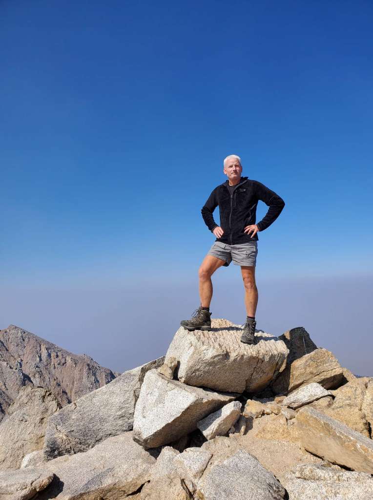
Since I was unsure about success or failure, day or night, date or death, I had not reserved a hotel room. I made the thousand plus miles to Cheyenne and arrived at the street doors of the Historic Plains Motel that Wifey had so nicely secured for me while I stewed, melted and regressed behind the wheel. It was failing but decent – cheap. I headed out, gassed up, and hit the nearest loud and inviting bar – in my hiking clothes from the training workout. A perfect 68°F at around 9:00pm local. The quart mason jar of designer beer definitely worked as I scanned my photos and texted Ed with a summit image.
I SLEPT!!! That night in the hotel, not at the bar – booze heads – what do you think I am???
Up and out before five again. Homeward… but this was the last long day – YES! I was home by 7:00pm local and glad to be off the road after another uneventful thousand plus day. Oh wait, I did see a big rig decimate a deer right in front of me – glad it was dead nearly immediately – awful. One more thing, I scored an “A” on license plates (45) missing DE, RI, SC, AL & HI.
Wifey greeted me warmly as did my striped and furry buddy. I am obviously not a professional, but I don’t know how the truckers do it. Yeah, the driving was mostly bullshit (long, no breaks for visits, no partner). The camping was not what I want (in personnel). The hike was good, beautiful, rugged and an accomplishment, but I would not do it again. That’s my 44th Highpoint; only the geared ones remain (excepting Mauna Kea of course – drive-up). Perhaps next year… or not at

Hi Mr Klausler,
A fascinating account, well written and very interesting. I followed along your journey with Google earth as this is an area (Lone Pine and the Alabama Hills, Sierra Nevada) that I would love to visit; although my interest is more of the desert floor than the mountains themselves should that particular dream come to pass.
Thanks for sharing, a very enjoyable read.
Regards,
Richard.
LikeLiked by 1 person
Hi Richard,
I did that map thing with another of his stories too. The details he gives make it fun to track, almost like you are actually there. You should absolutely go to that area if you can. The eastern slope if the Sierra Nevadas is spectacular imo. A lot of western movies were filmed there as well.
LikeLiked by 2 people
I enjoyed this quite a bit, you have a gift for relaying your experiences on paper and it made me feel as though I was with you.
LikeLike
Thank you kindly.
LikeLike